What Is RecoStaR?
For several years, Enedis has been continuously strengthening its requirements for as-built documentation to improve the accuracy of its electrical network records, reduce the risk of damage to underground infrastructure and streamline integration into Geographic Information Systems (GIS).
Following the implementation of France’s DT/DICT regulations, introduced as part of the European “damage prevention” framework, and as a result of a collaborative initiative led by Enedis, network owners and operators are required to provide reliable georeferenced positioning of their infrastructure by 2027.
RecoStaR, an implementation of the national StaR-Elec geostandard, defines the structure of vector data used for electrical utility as-built documentation and is gradually replacing the PGOC (Georeferenced Plan of Constructed Assets).
It includes:
High-accuracy, standardized Class A geometries
A structured data model based on utility assets (cables, cabinets, ducts, etc.)
Enriched attributes (accuracy, depth, topology)
Connectivity validation
Direct integration into Enedis’ GIS
For contractors and surveyors, this represents a significant change in working practices. Syslor enables you to meet these requirements today through a reliable, end-to-end production workflow with no manual data re-entry.
To better understand this common framework and its impact on utility network management, we have explored these topics in detail in our dedicated article on the StaR-DT and RecoStaR standards.
The objective: deliver complete, reliable and interoperable as-built documentation that can be immediately integrated into the information systems used by Enedis and local electricity distribution authorities.
Why Is RecoStaR Becoming Essential?
The legacy PGOC format no longer meets today’s requirements. Heterogeneous datasets, limited attribute information, complex validation procedures, frequent manual data re-entry and inefficient GIS integration have highlighted the need for a more robust standard.
RecoStaR addresses these limitations by providing:
Higher data quality: every asset is described consistently using the shared StaR-Elec data model.
Greater completeness: mandatory attributes reduce missing information and help prevent delays during project validation.
Faster GIS integration: standardized, structured datasets can be imported more efficiently into Enedis’ GIS.
Enedis has announced the progressive rollout of the RecoStaR format from 2025–2026, with the gradual replacement of PGOC for new projects.
For contractors, engineering firms and surveyors, this represents a significant change in working practices—but also an opportunity to improve productivity while delivering higher-value as-built documentation.
To support this transition, Enedis is progressively making its technical documentation and reference materials available, helping service providers adopt standardized formats such as RecoStaR.
PGOC vs. RecoStaR: What's Changing?
Key Differences Between PGOC and RecoStaR
Criteria
PGOC
RecoStaR
Data Type
Basic vector data
Structured vector data with asset attributes
Connectivity
Not systematically documented
Connectivity modeling and validation
Topology Validation
Limited
Automated standards-based validation
Structure
Limited standardization
National StaR-Elec Geospatial Standard
GIS Integration
Often manual
Simplified and automatable integration
Validation
High risk of rejection
More standardized validation process
Format
DGN, CSV and PDF
GML format for augmented reality visualization
These changes require greater data discipline but significantly improve the reliability of utility network data while helping reduce the risk of damage to infrastructure.
Who Needs to Comply with RecoStaR?
RecoStaR directly impacts:
Electrical utility contractors
Engineering and design consultancies
Licensed surveyors
As-built surveying service providers
Electricity distribution companies and local electricity authorities
GIS and surveying software vendors
Any organization producing georeferenced as-built plans for Enedis will need to be able to deliver files that comply with the RecoStaR format for applicable projects.
Key Technical Requirements of RecoStaR
RecoStaR introduces several key technical requirements, including:
Accurate survey points that comply with coordinate system and accuracy class requirements.
A data structure compliant with the StaR-Elec / Enedis data model, including asset types, dimensions, topological relationships and mandatory attributes.
Complete connectivity between assets to accurately represent the structure of the utility network.
Compliance validation of deliverables using dedicated tools such as Aloé, provided by Enedis to verify files before they are integrated into its GIS.
These technical requirements make it essential to use software that natively supports the RecoStaR data model and its associated business rules.
How to Generate RecoStaR Deliverables Easily with Syslor
This is where Syslor delivers a clear competitive advantage for contractors and utility service providers by offering a continuous digital workflow from field data capture through to RecoStaR export.
Georeferenced Photogrammetric Data Capture with EasyScan
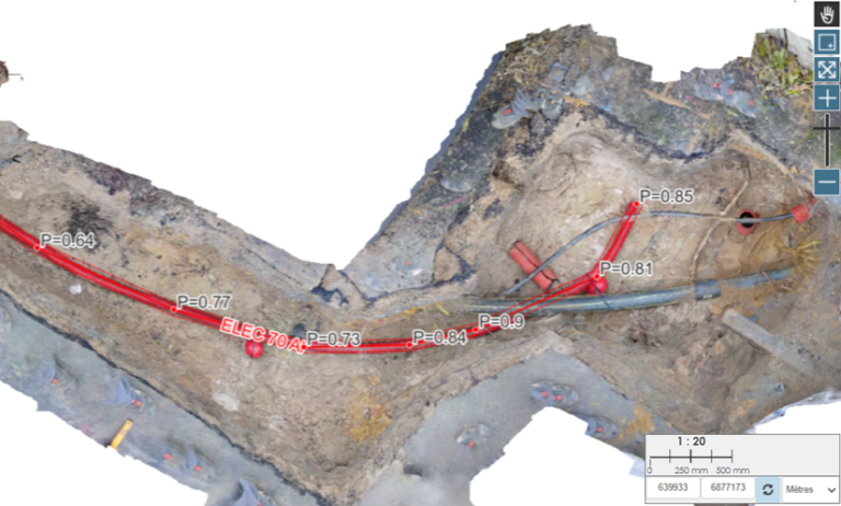
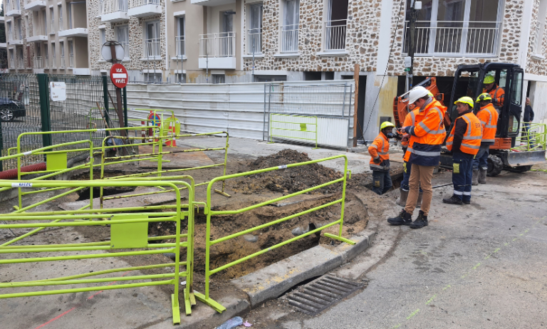
Using georeferenced video capture of underground utility networks, EasyScan enables field operators to create the imagery required to generate an accurate 3D model that serves as the foundation for as-built documentation.
As-Built Plan Production with EasyMap
EasyMap, Syslor’s vectorization platform, natively integrates the RecoStaR data model, built-in business rules (including connectivity and mandatory attributes) and pre-export validation to help ensure data quality before export.
Native RecoStaR Export
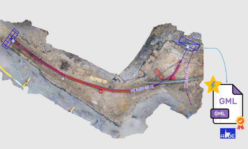
EasyMap generates RecoStaR-compliant files directly, ready for validation with Enedis tools such as Aloé, without manual data re-entry or format conversions.
2D, 3D and Augmented Reality Visualization
By exporting the as-built plan in GML format from EasyMap, utility networks can be visualized, verified and compared directly against field conditions in augmented reality using EasyView, Syslor’s augmented reality application. This provides an additional level of quality control and helps secure field operations before project delivery.
This end-to-end workflow reduces revision requests, accelerates project validation, ensures compliance with the RecoStaR standard and enables more reliable verification as well as more accurate future staking-out of underground utility networks.
Preparing Now for Enedis' RecoStaR Requirements
The rollout of the RecoStaR format marks a major milestone for everyone involved in electrical utility networks. By replacing PGOC with a more structured, comprehensive and fully interoperable standard, Enedis is driving the industry toward greater data reliability, transparency and operational efficiency—while helping reduce the risk of damage to underground infrastructure during construction and maintenance work.
For contractors, engineering consultancies and surveyors, this transition may appear demanding, but it also represents a strategic opportunity: to modernize production workflows, improve project quality and significantly reduce revision requests caused by non-compliant deliverables.
With an integrated workflow combining EasyScan for field data capture, EasyMap for vectorization and native RecoStaR export, and EasyView for 2D, 3D and augmented reality visualization, Syslor enables organizations to embrace these new requirements with confidence. You can already produce reliable, RecoStaR-compliant deliverables that are ready for validation with Aloé, while improving efficiency and increasing competitiveness.
RecoStaR is more than a new requirement—it is an opportunity to adopt higher standards of quality, productivity and performance.
Looking to prepare for Enedis’ RecoStaR requirements or modernize your as-built documentation workflow? Get in touch with our team to learn how Syslor can help you implement these new industry standards.
📧 contact@syslor.net
📞 +33 (0)3 87 63 58 92
🌐 www.syslor.net/en