The all-in-one vectorization solution for your as-built surveys.
Transform your photogrammetric data into reliable and accurate as-built plans, leveraging tailored attribute libraries, orthophoto stitching for long linear assets or large areas, and a 2.5D/3D dual view for reliable and intuitive elevation control.


Everything you need
for reliable as-built surveys.
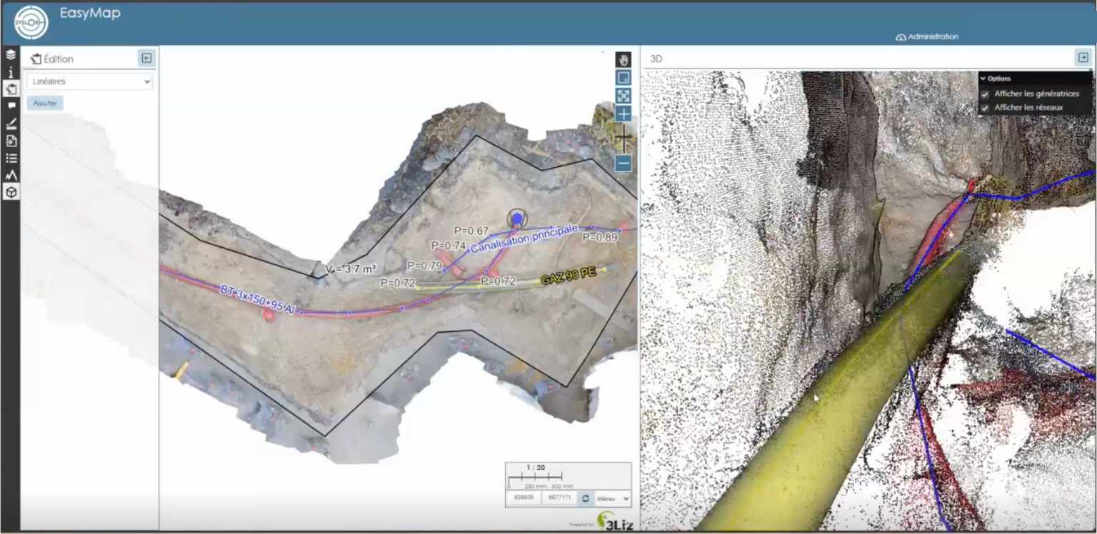
2.5D / 3D dual view
Combine the simplicity of 2.5D drawing with the elevation control of the 3D point cloud to adjust your geometries with accuracy. This dual view makes it easier to validate complex areas and improves the reliability of your as-built surveys.
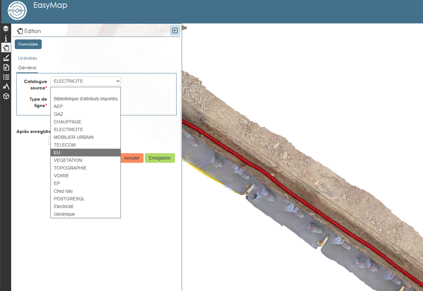
Customizable attribute library
EasyMap provides customizable attribute libraries to structure your objects according to your business needs: electricity, drinking water, district heating, telecom, wastewater, stormwater, etc.
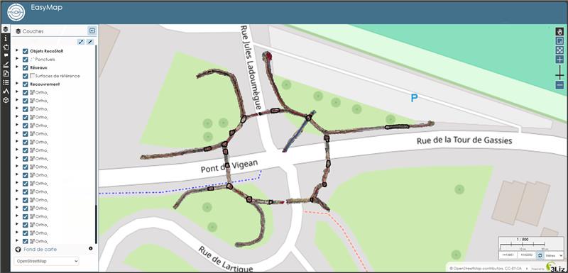
Model stitching
Merge multiple photogrammetric surveys into a consistent overall view. Ideal for long linear assets: continuous tracking, unified visualization, global statistics, base maps, and topological continuity.
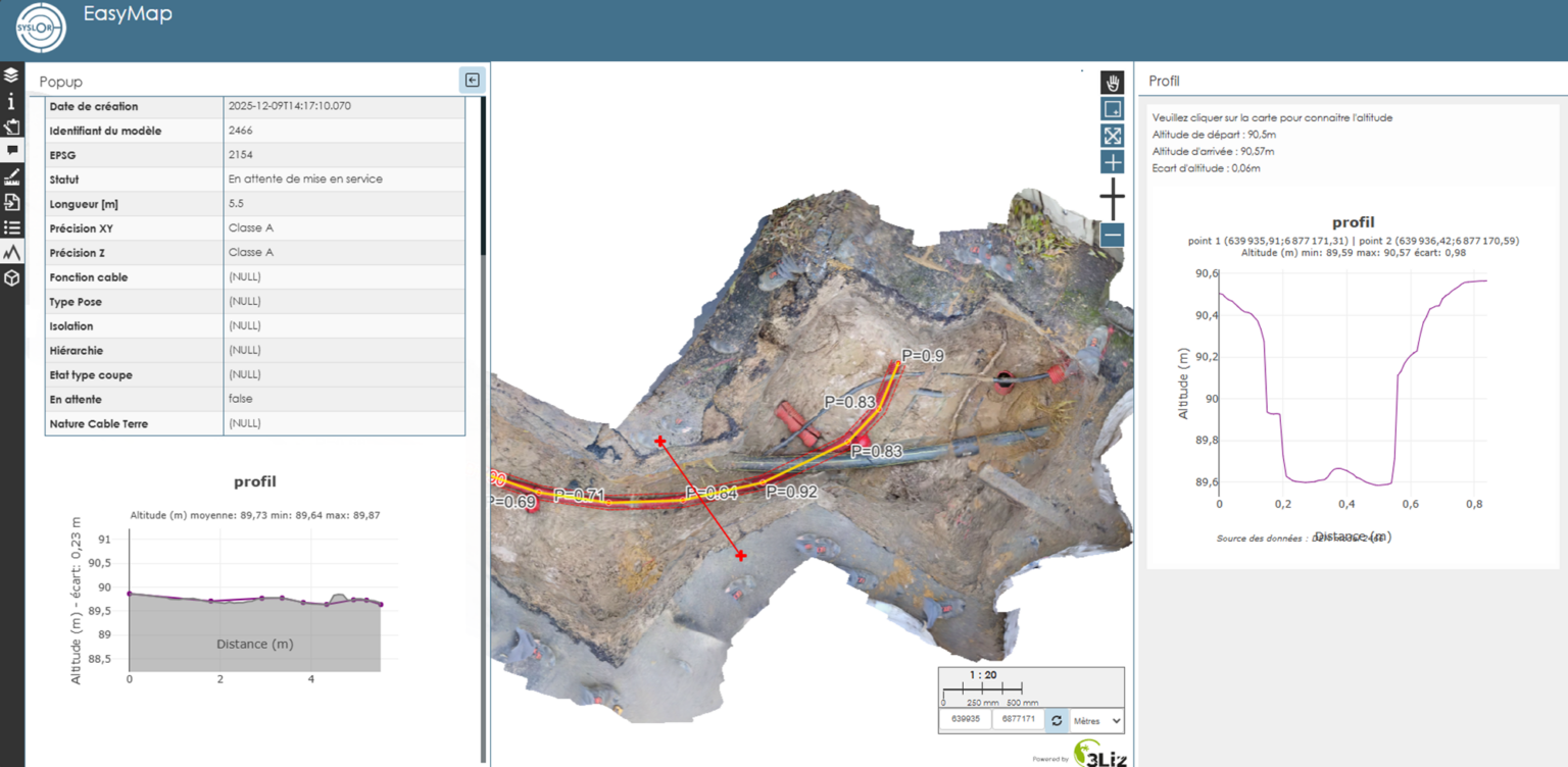
Longitudinal & cross profiles
Instantly generate cross-sections to control depths, analyze terrain, validate sensitive areas, and check network intersections. A key feature for infrastructure and utility network projects.
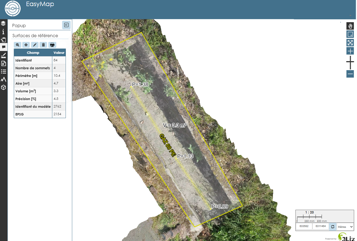
Accurate measurements
Calculate in one click: linear distances, surfaces, volumes and earthwork quantities, elevations and level differences. The centimeter-level accuracy provided by EasyScan ensures reliable results without re-entry.
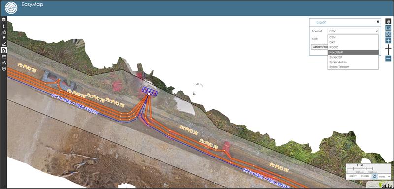
Multi-format exports
EasyMap exports in DXF, CSV, RecoStaR and PGOC in a clean, ready-to-use format, even for regulatory deliverables, without additional editing. On request, we format your exports according to your required cartographic standards.