EasyField – Hero
Field notebook · Setting out, surveying & earthworks

Set out, survey and manage earthworks with centimetric-level accuracy, from your smartphone.

EasyField is your digital field notebook for site setting out, earthworks monitoring and fast, reliable and intuitive surveying, with unlimited usage and compatible with tablets and smartphones.

Request a demo Learn more
GNSS accuracy · Real-time guidance
Plan visualization & one-click export
Android & iOS compatible · Unlimited usage
Developed in France
Ils nous font confiance
They trust us
Enedis
Engie
Eurovia
Colas
Eiffage
DTP2i
Nonet
Omexom
RazelBec
Nouveau logo
FuturMap
Enedis
Engie
Eurovia
Colas
Eiffage
DTP2i
Nonet
Omexom
RazelBec
Nouveau logo
FuturMap
EasyField – Bénéfices
Who is EasyField for?

Simplify your field operations with accuracy

EasyField combines centimeter-level accuracy with ease of use to meet the needs of underground network operators and public works professionals. Its intuitive interface requires no surveying expertise, saves time on site setting out and surveying, while ensuring full interoperability with your existing software.

Surveyors

Manage your operations remotely, share data with field teams, and collect survey data without unnecessary travel.

Field teams

Easily access your project from your smartphone or tablet with an intuitive field notebook that simplifies every operation.

EasyField – Fonctionnalités clés
Key features

Everything you need in the field

Topographic survey

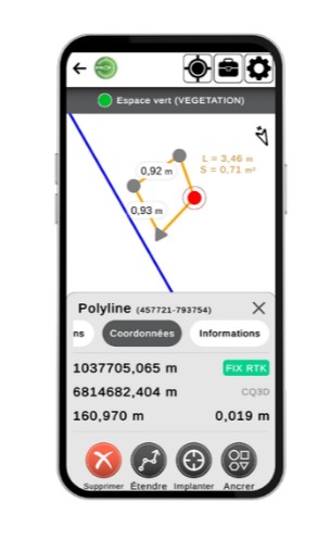
Topographic point surveying

Capture field reality to feed your digital plans. EasyField simplifies the collection of various geometric shapes (points, polylines, circles, arcs) as well as linear and surface measurements directly on site, with export in DXF and CSV formats for seamless integration into your usual software.
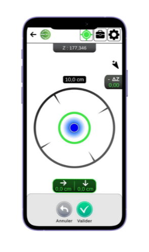
Setting out

Setting out

EasyField turns your digital plans into an operational guide in the field, ensuring alignment between your designs and their execution. The application supports DXF, DWG and DGN formats, and allows you to integrate base maps to contextualize your operations directly on site.
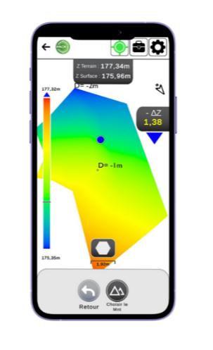
Earthworks

Earthworks

From your design surfaces, EasyField identifies cut and fill areas. Leverage earthworks directly from a digital terrain model (DTM) to set out and monitor your earthworks in real time, optimizing material movements on site.

EasyField – Pourquoi choisir EasyField ?
Why EasyField?

Surveying, setting out, earthworks: your digital field notebook

Discover the concrete benefits that transform your daily field operations.

Time savings

Reduce the time spent on field surveys thanks to an intuitive interface and real-time indications of survey accuracy.

Ease of use

Designed for field teams, no surveying expertise is required. Your smartphone becomes an intuitive professional tool that all your team members can master in just a few minutes.

Performance

From setting out to earthworks, monitor your projects in real time. Direct export to your CAD software for a seamless production workflow. Your field teams gain autonomy and efficiency.

Unlimited usage

Use EasyField without constraints: benefit from unlimited usage across all your projects, with no additional costs or token-based system.

Free demo

Discover EasyField
in detail

An expert will show you how EasyField, combined with Syslor applications, enables your teams to gain autonomy in the field while ensuring reliable data at every stage of your projects.

100% personalized demo Tailored to your field context, use cases, and constraints.
Simple and efficient format A clear presentation to quickly understand how EasyField integrates into your projects.
Centimeter-level accuracy in real conditions See the performance and results you can achieve on your projects.

Get a free demo

An expert shows you how EasyField meets your field needs.

Demo EasyField ENG

By submitting this form, you agree to receive our communications.

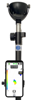
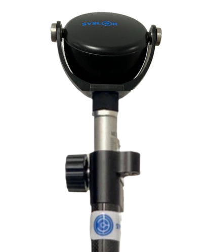
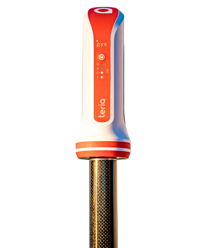
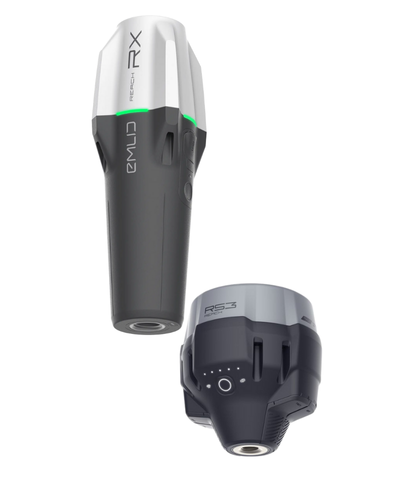
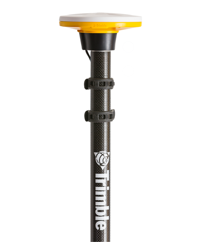
Compatible with multiple GNSS receivers on the market

EasyScan integrates with the leading receivers on the market — leverage your existing equipment for accurate georeferencing, without additional purchases or unnecessary environmental impact.

Ready to optimize your
field operations?

Join the hundreds of professionals who already trust us.

Téléchargez l'application EasyField

Accédez à nos services où que vous soyez avec notre application disponible sur iOS et Android.

Resources

Go further

Scroll to Top