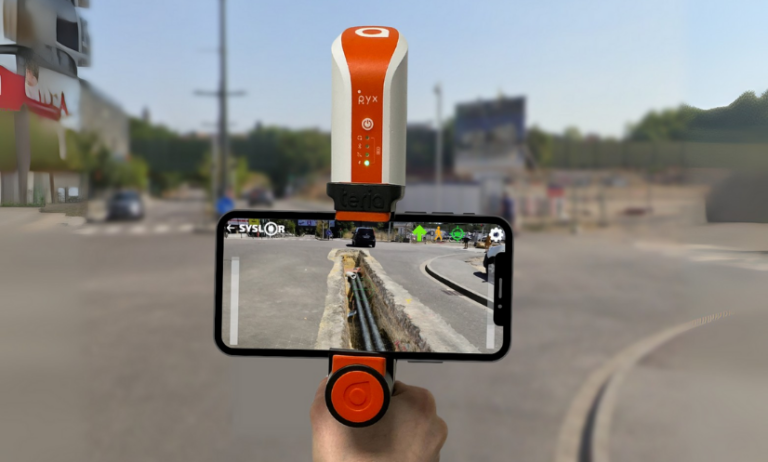
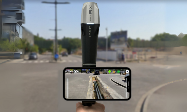
On construction sites, each photogrammetric survey generates its own dataset — an orthophoto, a point cloud, sometimes dozens of separate files to manage. Over time, these fragmented deliverables become difficult to work with. Misaligned joins, overlapping zones, or missing areas can compromise the overall topographic consistency of the project.
For surveyors, engineering offices, and project managers, the issue is often the same: getting a comprehensive and accurate view of the site requires time-consuming manual work, which increases the risk of errors.
This is exactly the challenge addressed by the merging of orthophotos and point clouds.
By bringing all survey data together into a single, unified, georeferenced model, this process delivers a continuous, coherent, and readily exploitable view of the project.
Beyond improving readability, accuracy, and efficiency across the entire production chain, it also saves a significant amount of time for survey teams when preparing their deliverables.
To better understand its advantages, let’s start by defining what the merging of orthophotos and point clouds actually is.
What Does Merging Involve?
Merging consists of combining several separate orthophotos or point clouds into a single, unified, and consistent view, while preserving the original centimetric accuracy and georeferencing.
Each area captured during the photogrammetric survey is repositioned within the same coordinate system to create a continuous mosaic of the project.
The merging process relies on rigorous management of metadata and spatial coordinates. This ensures that all datasets align perfectly — without offset, elevation gaps, or quality loss.
The result is a unified model that faithfully represents the entire site, enabling consistent and accurate measurements across the whole area.
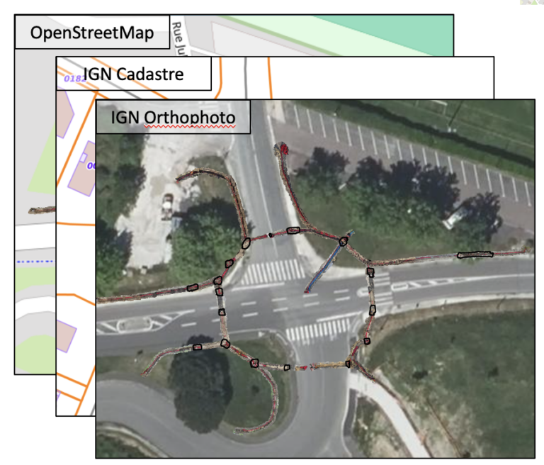
With this merging process in place, it becomes possible to visualize, measure, and vectorize an entire project from a single unified dataset, regardless of the project’s size or complexity.
Now that the concept of merging is clear, let’s look at how it concretely improves the production and use of photogrammetric deliverables.
Why Merge Your Photogrammetric Deliverables?
Merging is not just a simple file combination — it’s a key step that allows teams to fully leverage the richness of photogrammetric data while ensuring the consistency of all deliverables.
Here are the main advantages it brings, both in the field and in the office.
Gain a Global View of the Project and In-Situ Context
Merging provides a comprehensive view of the construction site, restoring the entire area within a single, continuous representation.
It makes it possible to place each work zone within its broader environment — a valuable advantage for large-scale sites or linear projects such as roads, utilities, or railway corridors.
This unified view helps teams understand how different areas interact, for example between the construction footprint, the surrounding environment, and existing underground or above-ground networks.
Improve Vectorization Accuracy and Spatial Consistency
By merging several orthophotos or point clouds within the same reference system, merging eliminates alignment errors between deliverables.
It ensures a homogeneous topographic continuity, which is essential for:
the precise vectorization of utility networks,
the production of reliable as-built plans,
and volume or surface calculations.
Each measurement is therefore based on a coherent, georeferenced dataset, with no risk of misalignment between areas.
Simplify the Use of Your Deliverables Through Centralized Data
With merging, there’s no need to juggle multiple files anymore.
Orthophotos and point clouds are grouped into a single unified view, speeding up processing and reducing the risk of errors during plan production or verification.
This approach also simplifies importing deliverables into standard GIS or CAD software (DGN, DXF, CSV): a single, complete, georeferenced file, immediately ready for use by all project stakeholders.
Enhance Collaborative Work
By providing a single, consistent source of truth, merging makes collaborative work much easier.
Everyone works from the same reference dataset, improving both validation and quality control of deliverables throughout the entire project lifecycle.
Looking Ahead: Tracking Project Progress Over Time
In the long term, merging opens the door to new possibilities:
tracking the evolution of a construction site over time,
overlaying successive surveys (before and after works),
and building a true digital twin of the project.
This approach will make it possible to accurately analyze site transformations — from earthworks to network installation — and to ensure complete traceability of all operations.
How Syslor Facilitates the Merging of Orthophotos and Point Clouds
The merging of orthophotos and point clouds truly reveals its value when it’s part of a seamless workflow — from data capture in the field to data processing and analysis. This is exactly what Syslor offers through two complementary solutions: EasyScan for photogrammetric surveying, and EasyMap for the visualization and processing of deliverables.
EasyScan – Accurate and Standardized Photogrammetric Capture
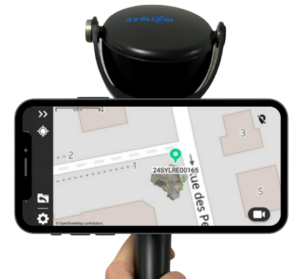
Everything starts in the field with EasyScan, the solution designed to perform georeferenced photogrammetric surveys.
Each survey performed with the EasyScan application ensures centimetric accuracy and structured, standardized data.
As a result, right from the survey phase:
orthophotos and point clouds are perfectly aligned within the same reference system;
deliverables are immediately available in EasyMap for further processing and analysis.
EasyMap – Merging and Centralized Management of Deliverables
Once the surveys are completed, EasyMap (formerly Sysmap) takes over. The tool, available directly through the Syslor web portal, assembles orthophotos and point clouds from different photogrammetric surveys to generate a unified overview of the entire project.
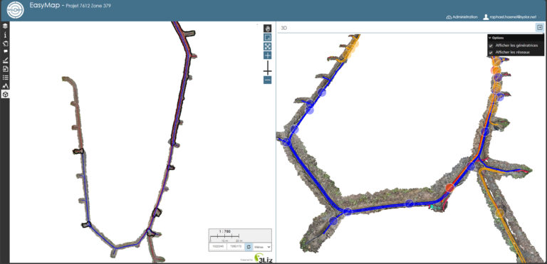
The user then gains access to a comprehensive environment to:
visualize the construction site as a whole,
vectorize networks on a consistent base,
perform measurements and volume calculations without discontinuities,
and export reliable as-built plans with full confidence.
This automation ensures a smooth, continuous production workflow, from field survey to final deliverable delivery.
Ready-to-Use and Interoperable Deliverables
Thanks to the complementarity between EasyScan and EasyMap, all data is aligned, merged, and immediately usable across any working environment — CAD, GIS, or collaborative platforms.
The result: greater accuracy, less post-processing, and improved traceability throughout the entire project lifecycle.
Want to learn more? Request a demo.
A Unified Vision for More Accurate and Actionable Deliverables
The merging of orthophotos and point clouds is not just a technical step — it’s a key requirement for ensuring the reliability and readability of photogrammetric data.
By consolidating all surveys into a single unified model, teams gain a coherent overall view, consistent accuracy across the entire area, and significant time savings in deliverable production.
📖 Also read: EasyMap introduces new features: customization, 3D, and model merging.

