Preserving infrastructure knowledge throughout its lifecycle.
Plans, topographic surveys, geographic information system (GIS) data, georeferenced photographs, as-built documentation, technical attributes, intervention histories… As construction and maintenance operations progress, infrastructure generates an increasing amount of data.
This information is essential. It tells us where assets are located, how they were built, what changes have been made and under what conditions future interventions can be carried out.
But its lifespan extends far beyond that of the project that produced it.
Data acquired today may be used several years later, by another team, another service provider or with new tools. In the meantime, the physical assets themselves may also have changed: a network may have been relocated, a road redesigned, equipment replaced or new infrastructure created.
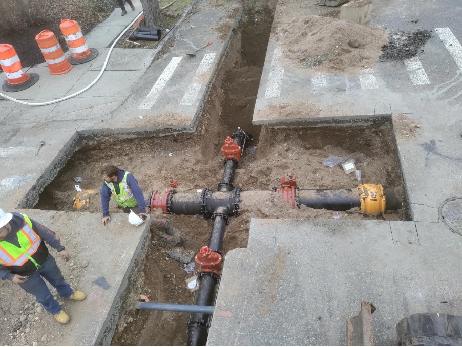
This is where the challenge lies: how can reliable and usable knowledge of infrastructure be preserved over time?
This challenge concerns all stakeholders who produce, use or transmit infrastructure information: local authorities, utility operators and network managers, contractors and works service providers, engineering firms and surveyors, as well as industrial and sensitive sites.
They do not all use data in the same way. Some produce it in the field, others process and transmit it, while others need to use it and keep it up to date over time. But they all depend on the same thing: being able to retrieve reliable information, understand where it comes from and know how far they can trust it.
A wealth of data, but knowledge that can become less reliable
The problem is not a lack of data. On the contrary, organisations have been accumulating it for years.
However, it comes from multiple sources: detection operations, survey campaigns, successive construction projects, as-built plans, maintenance operations, engineering firms, contractors, surveyors, internal departments and utility operators.
Methods and tools also evolve. Software changes, information systems migrate, formats succeed one another, and service providers and teams change.
Over time, some information is re-entered or moved. Other information is no longer updated. Some data loses its link to the documents or surveys from which it was produced. Other information may simply be lost.
Meanwhile, the infrastructure itself continues to evolve.
Gradually, a gap can emerge between the actual state of the assets and the knowledge available to document them. Preserving data reliability therefore means not only retaining its context, but also being able to incorporate new information produced during successive interventions so that knowledge of the assets continues to evolve with them.
The issue is therefore not simply having data available. It is also being able to determine whether that data accurately reflects reality and whether it can be trusted.
When data loses its context, it loses part of its value
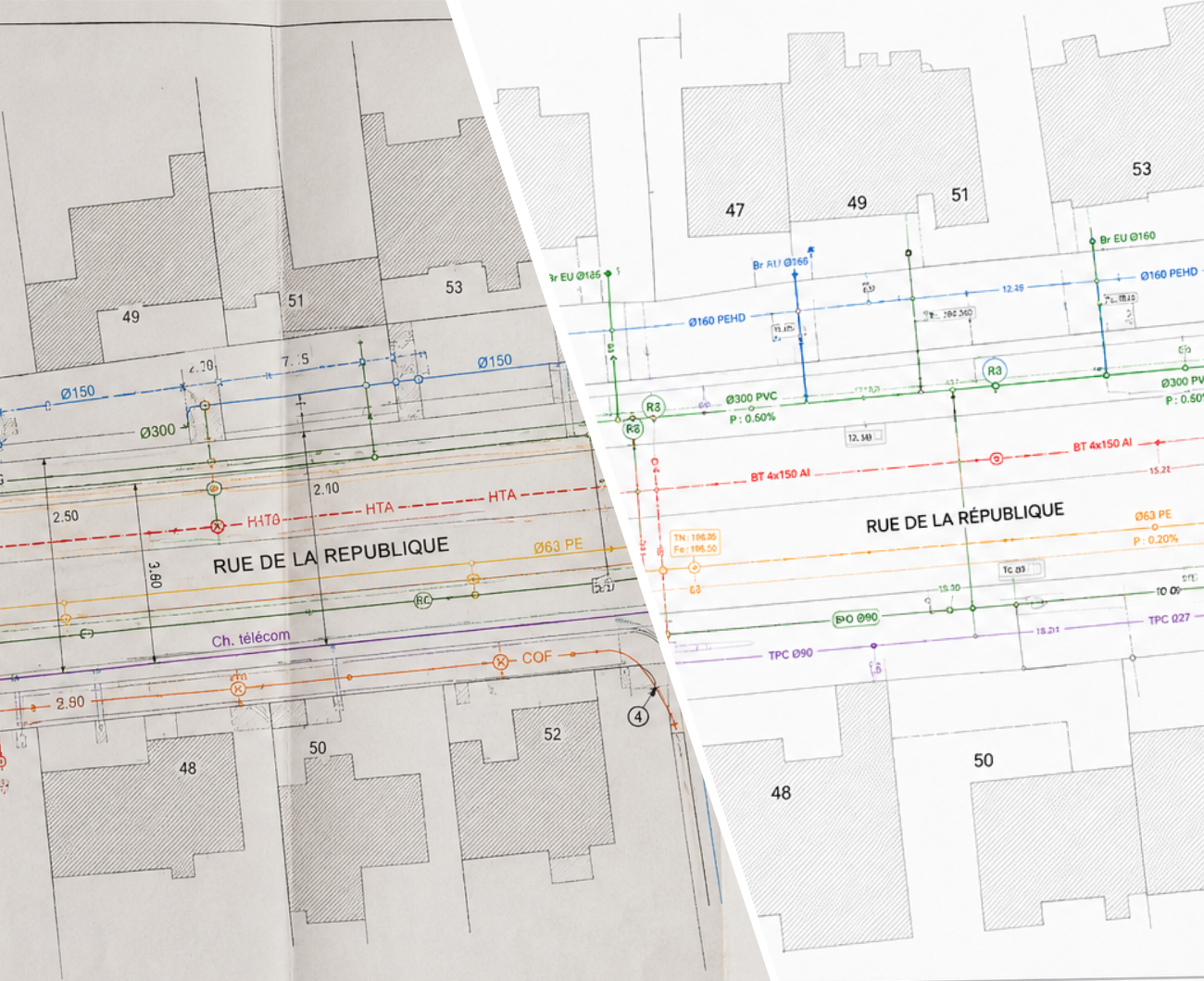
Imagine a network represented in a GIS.
Its position may appear perfectly usable. Yet several years after it was acquired, certain questions become essential:
- When was this data produced?
- Which survey was it based on?
- Which method was used, and with what level of accuracy?
- Which service provider or team produced it?
- Which intervention or project version does it correspond to?
- Are there photographs, surveys or documents that can be used to verify it?
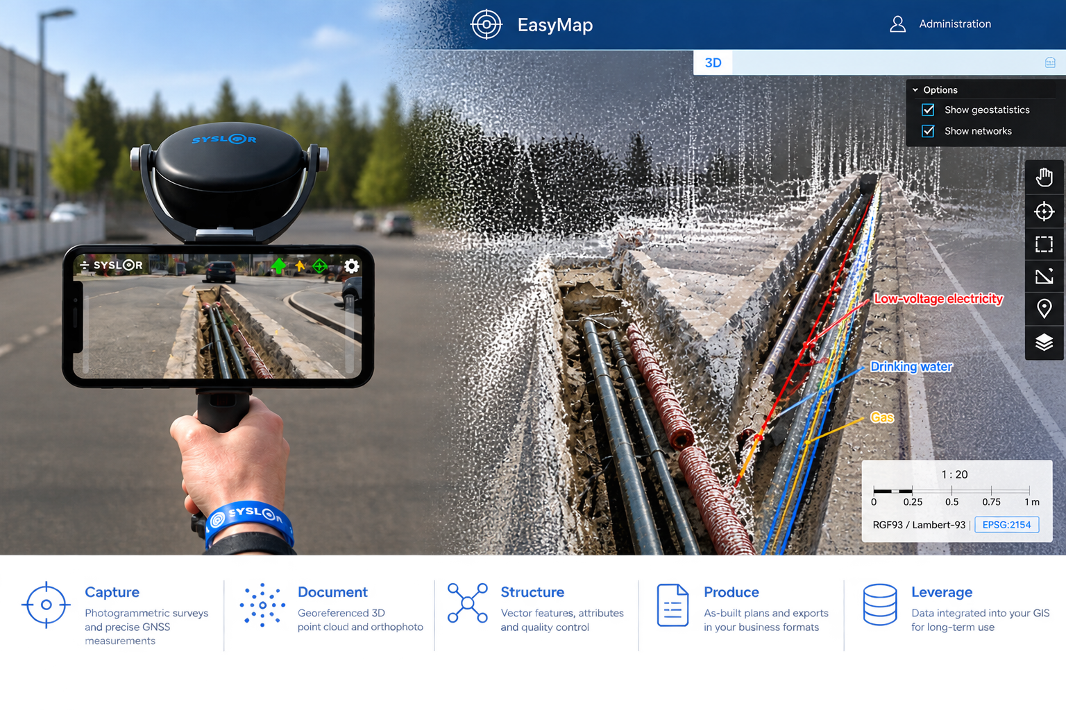
If this information is no longer available, it becomes difficult to assess how much confidence can be placed in the data.
The consequences are very tangible: document searches, contacting former stakeholders, additional field checks, or even new network detection or location operations.
When the available mapping no longer makes it possible to locate an asset with sufficient accuracy, additional investigations or location operations may indeed become necessary. These interventions can represent a significant additional cost for the stakeholders involved, with responsibility for those costs varying depending on the type of investigation and the context in which it is carried out.
These costs are compounded by delays, new survey campaigns and, in some cases, decisions made on the basis of information whose reliability remains uncertain.
Reliable asset data is therefore not simply accurate data. It is data whose origin, context and history remain understandable over time.
This is the core challenge of traceability.
Data that must remain reliable from one stakeholder to another
Data accompanies infrastructure through different stages of its lifecycle. Uses and responsibilities vary depending on the stakeholders involved, but everyone has an interest in preserving its quality and continuity.
For a local authority, the challenge is to build and maintain reliable asset databases despite successive interventions, changes in service providers or changes in teams and departments. This knowledge of utility networks helps prepare future projects, monitor completed works and support planning decisions with reliable, up-to-date information. The challenge today is to ensure that this knowledge, centralised in geographic information systems, remains complete, current and traceable over time.
For a utility operator or network manager, the challenge is to maintain reliable, up-to-date knowledge of assets in order to secure interventions, plan works and monitor the evolution of the infrastructure over time. Collecting, structuring and updating field information makes it possible to build an asset database that can be used in GIS and shared between different departments and service providers.
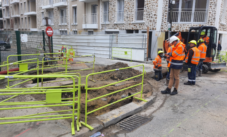
For a contractor or works service provider, one of the main challenges is to document field interventions accurately and ensure the continuity of that information through to the office and the project owner. Traceability of interventions, reliable as-built surveys and the sharing of field data make it possible to verify that work has been carried out correctly, limit information gaps and provide reliable documentation for future interventions.
For an engineering firm and its surveyors, the challenge is to use data collected in the field efficiently and maintain its reliability through to the production and delivery of final deliverables. Better continuity between the field and the office reduces duplicate data entry and information gaps, facilitates data checking and enables clients to receive accurate, documented and directly usable information.
For an industrial or sensitive site, having reliable and up-to-date knowledge of utility networks is directly linked to intervention safety and service continuity. Incomplete or outdated mapping can expose teams to risk, cause damage or disrupt site operations. Documenting interventions, tracking updates and retaining accurate, usable data makes it easier to prepare maintenance and construction operations while maintaining reliable knowledge of existing infrastructure.
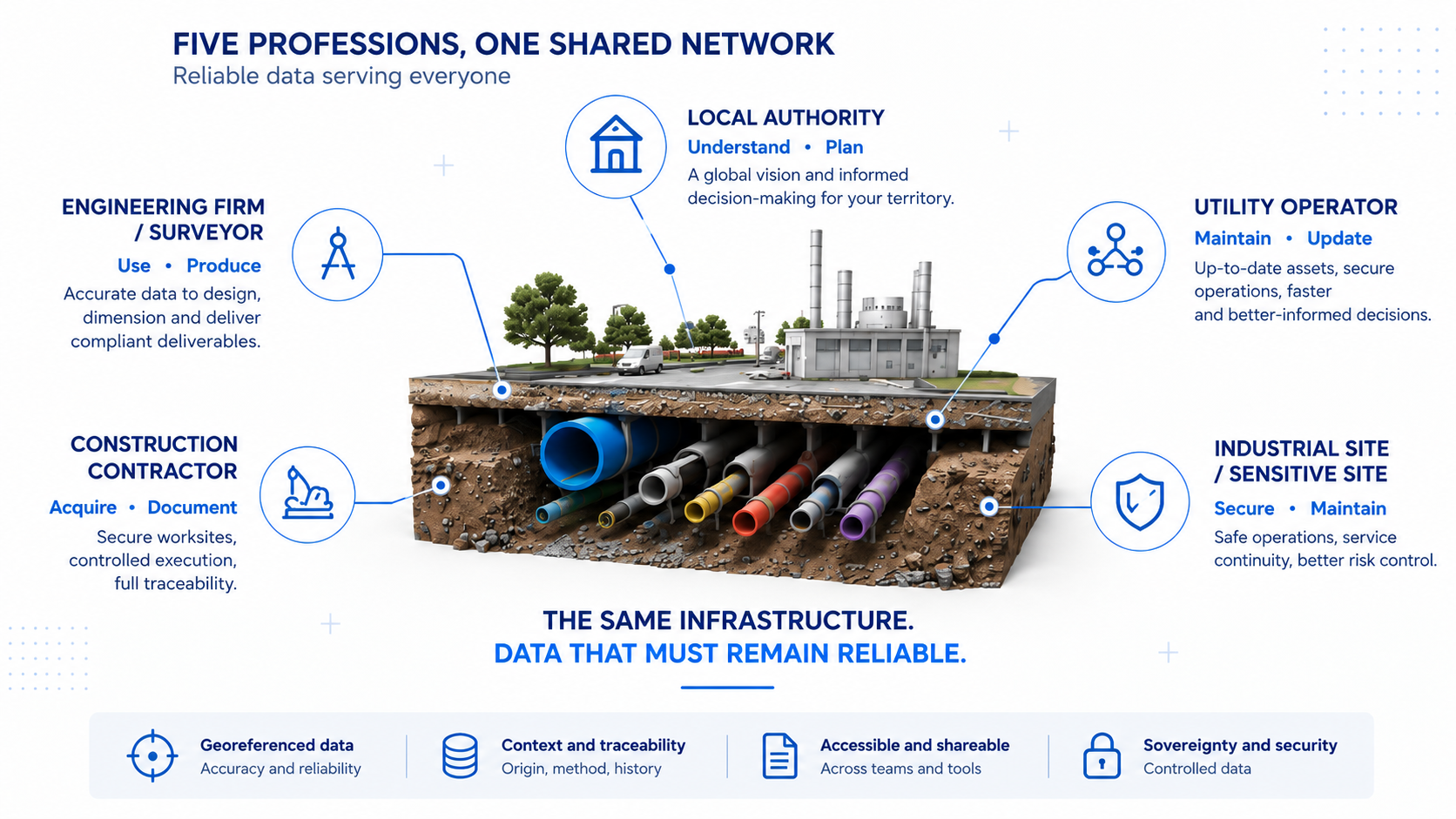
Data therefore circulates between different tools, teams and organisations. Its reliability depends as much on its initial quality as on our ability to preserve its context and continuity throughout these exchanges.
Digital technology helps preserve data continuity
For a long time, part of the difficulty came from information being scattered across different locations.
A plan might be stored in one folder, photographs elsewhere, geographic data in a GIS, and certain contextual information in reports or in the knowledge of the people who took part in the project.
Digital tools now make it possible to approach this issue differently.
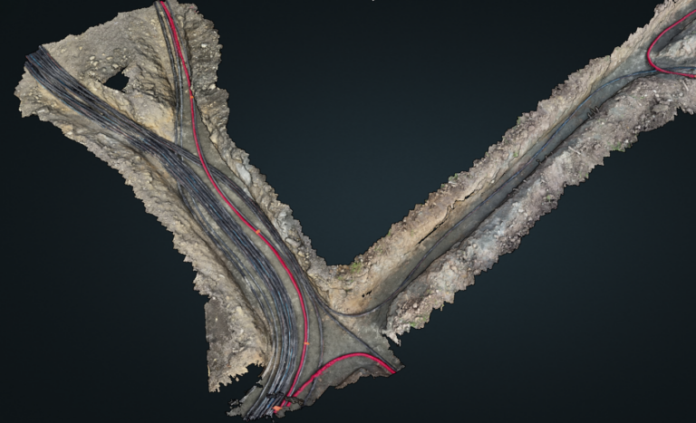
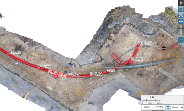
From the moment data is acquired in the field, new measurement technologies make it possible to produce georeferenced digital data and associate it with various contextual elements: photographs, acquisition date, project information, technical attributes or related documents.
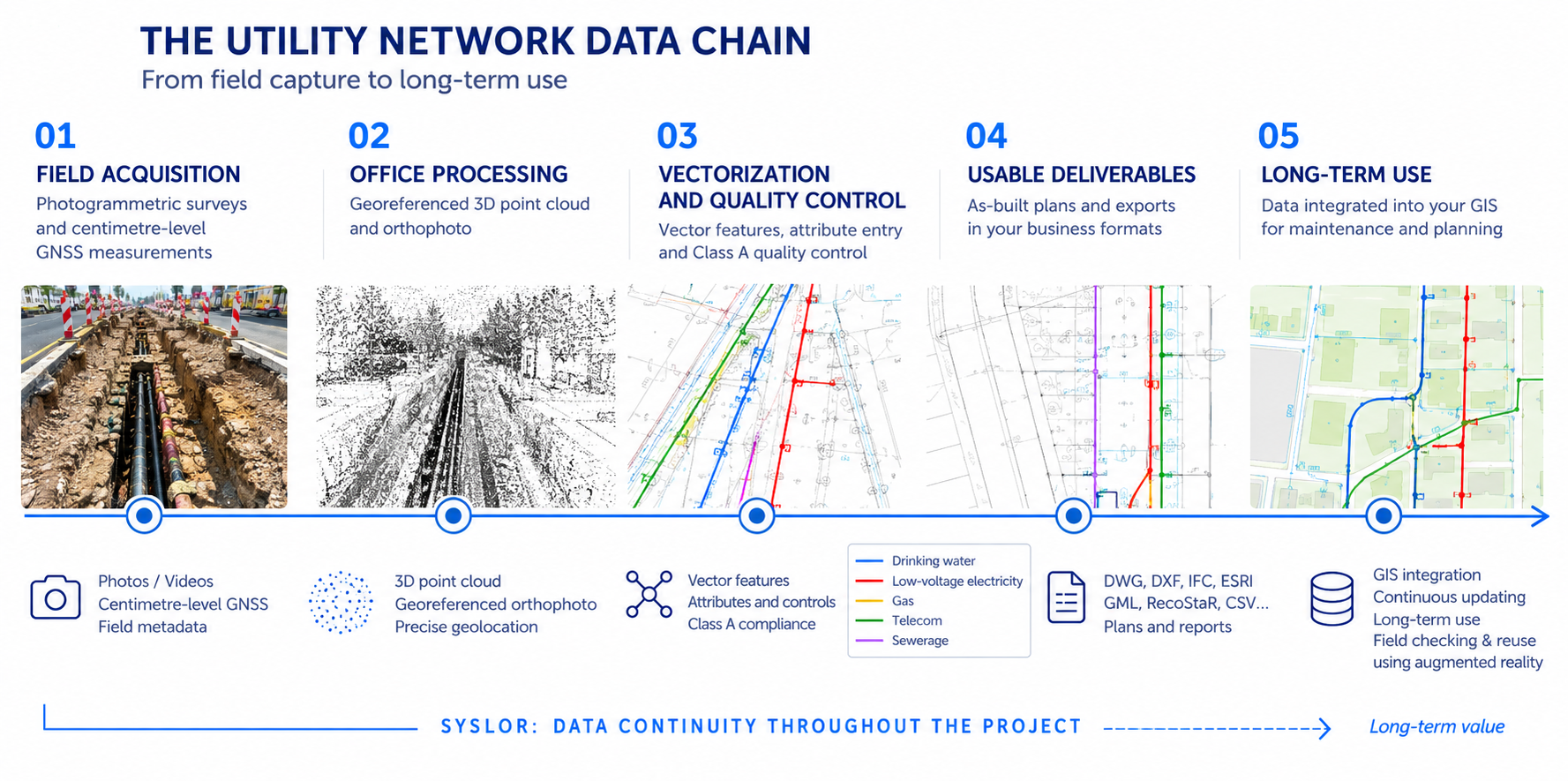
But the quality of asset data is not determined solely when it is integrated into a GIS or database. It also depends on how it was acquired in the field, documented, processed and transmitted throughout the project. Preserving this continuity from the moment the data is produced helps limit information loss between the different stakeholders who will need to use it.
The challenge is therefore to preserve this continuity throughout the different stages of the project: field acquisition, transmission, processing, use and production of deliverables.
This is one of the roles of EasyDesk, Syslor’s web portal. It centralises projects and provides the link between applications used in the field and work carried out in the office. Utility plans, surveys, data entered in the field, orthophotos, point clouds, templates and attribute libraries can therefore all be integrated into the same production chain, from acquisition through to the final deliverable.
This continuity between the field and the office helps reduce duplicate data entry, duplication and information gaps between the different stages of a project. Data remains accessible, up to date and synchronised, while unified management of projects, templates and attributes helps ensure traceability.
Better structuring from the project stage onwards subsequently makes the data easier to understand, use and transmit over time. Data produced in the field is no longer merely a one-off deliverable: it helps build better-documented knowledge of infrastructure that can be used during future interventions.
Building today the knowledge that will be useful tomorrow
Infrastructure has a long lifespan. The teams, service providers, methods and tools that support it will inevitably evolve.
The real challenge is therefore not simply to produce reliable data at the time of a project. It is to ensure that this data remains understandable, accessible and usable several years after it was acquired.
This starts in the field. Data that is correctly acquired, documented and transmitted has a stronger foundation for subsequent integration, updating and long-term use.
For a local authority, this continuity helps build and maintain reliable knowledge of its networks and territory. For a network manager or industrial site, it provides a better understanding of assets and helps prepare future interventions. For a contractor, engineering firm or surveyor, it makes it easier to document, use and transmit the information produced at each stage.
In every case, the challenge remains the same: to capitalise on each intervention rather than gradually having to rebuild knowledge that already existed.
The value of data therefore lies not only in its accuracy at the time it is produced, but in our ability to retrieve it, understand it and trust it tomorrow.
At Syslor, we contribute to this continuity from the moment data is produced: from field acquisition to office processing and through to the production of deliverables. By structuring this production chain more effectively, data generated during projects can subsequently be used and transmitted more easily over time.