The challenge: reliable, fast and accessible network marking in the field
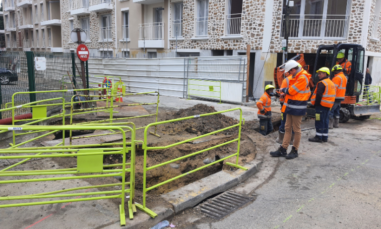
When public works are carried out on buried networks, there are many issues at stake: guaranteeing the safety of operators, ensuring the accuracy of staking markings and their maintenance, and reducing intervention costs. Yet in many cases, operators in the field are still working with paper plans, which are sometimes incomplete and often difficult to interpret.
The result: errors, extra costs, damage to structures… and a considerable waste of time.
To meet these challenges, Syslor has developed EasyView, a solution combining augmented reality and centimetre-level accuracy.
Solution deployed: EasyView, the new generation of augmented marking
The EasyView solution is based on a triple innovation:
- The Proteus GNSS receiver for marking accuracy of between 1 and 3 cm, compliant with Class A (CCTA certified)
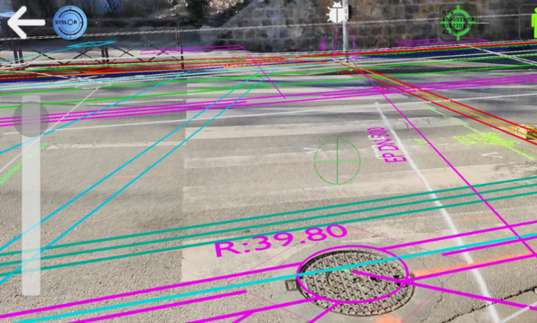
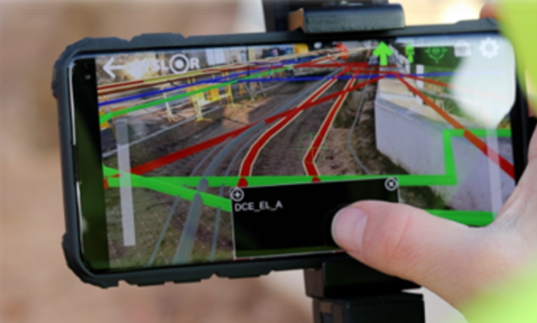
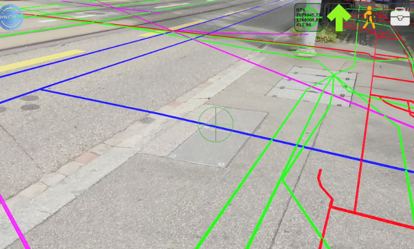
- The EasyView augmented reality application for displaying networks directly superimposed on the real environment
- Automated processing of mapping data to display buried networks
With EasyView, a single operator in the field can use his smartphone or tablet to view the condition of buried networks and their attributes in real time, and mark out stakes with an accuracy of 1 to 3 cm.
Results observed on site
Deploying EasyView has generated measurable and immediate results:
- Time savings of x2 to x4 on marking and staking
- Cost savings of 35 to 40% over 3 years on marking services
- Less damage to structures, so fewer incidents and rework
- No more paper printouts and optimised travel: a real plus in terms of CSR
- Operation possible even in a degraded GNSS environment thanks to loading of the map base.
Key features used
- Augmented reality display of buried networks
- Display of network attributes: type, class, depth, diameter, installation date, etc.
- Generation of marking certificates for traceability and compliance
- Offline mode: can be viewed even without a GNSS signal
On-site feedback
Users praise the ease with which it can be used, the reliability of the markings (comparable to triangulation methods), and the ability to intervene quickly without the need for a paper plan. Inspection visits are made easier, with faster decision-making and immediate checks if there is any doubt about the presence or otherwise of sensitive networks.
Some customer feedback:
“Marking is as accurate as with triangulation.”
“We no longer need to get out the paper plan. It’s all in the phone.”
“When there’s an emergency or an unexpected visit, I can check in 30 seconds.”
“It’s simple, fast and has saved me from making mistakes.”
Score quickly, accurately and independently
EasyView is an innovative and proven solution to the challenges of marking and staking underground networks. Thanks to augmented reality, geo-referenced data and an intuitive mobile interface, operators gain in efficiency, safety and autonomy.
Would you like to try out EasyView on your worksites?
Contact us or request a demonstration.