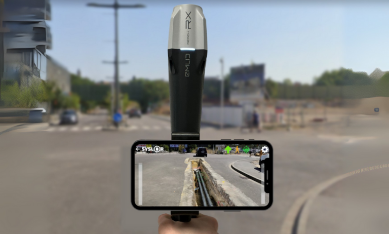
Syslor is enhancing its EasyMap platform with three new features that make daily operations even smoother for field and design teams. EasyMap is the drawing and tracing tool accessible directly from the Syslor portal, used by EasyScan users to edit orthophotos and point clouds generated from photogrammetric surveys.
It enables users to transform survey data into usable plans, control altimetry, and monitor project progress.
The new features focus on three key aspects:
- Customizable vectorization,
- The move from 2.5D to full 3D,
- Model concatenation for an overall project view.
All these improvements share a common goal: simplify deliverable production, increase accuracy, and ensure better continuity between all project stakeholders.
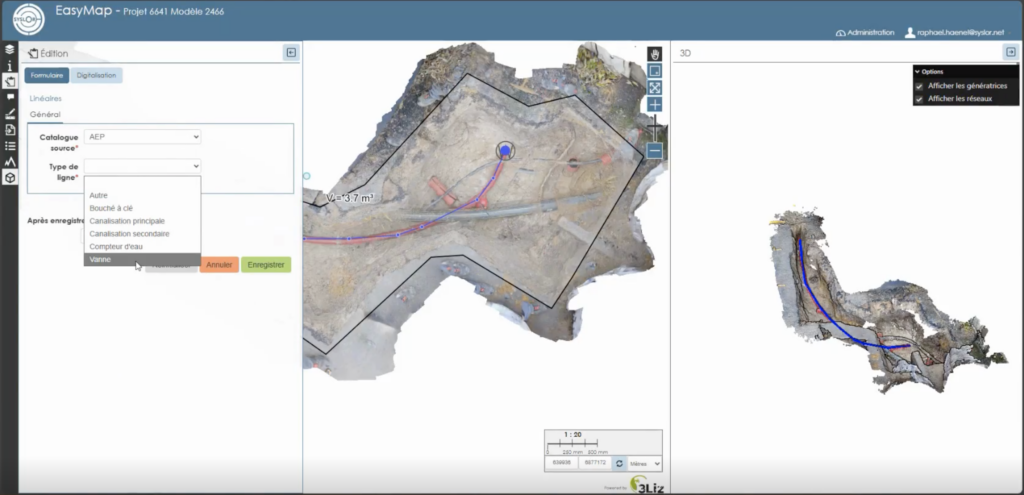
Customize Vectorization to Match Your Standards
Attribute Libraries Tailored to Your Needs
Every company applies its own mapping standards. EasyMap now includes customizable attribute libraries, grouping the necessary object families (electricity, water, heating, telecom, wastewater, etc.) in line with your internal practices.
Ready-to-Use, Standards-Compliant Exports
Generated plans automatically comply with your nomenclatures and export formats (DXF, DGN, etc.). No more manual adjustments — exports from EasyMap are structured, standardized, and complete, saving time and reducing the risk of error.
Control and Edit in 3D While Keeping the Simplicity of 2.5D
The Limits of 2.5D
2.5D remains widely used because it’s lightweight and easy to handle. However, it reaches its limits when verifying altimetry or working with overlapping networks.
On the other hand, navigating within a 3D view allows for continuous control, but it is less intuitive and straightforward due to the complexity of three dimensions.
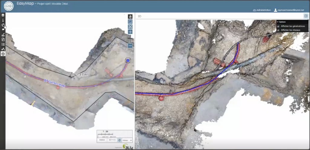
Dual View for Greater Precision
EasyMap now offers a dual view:
a classic 2.5D view on the orthophoto to maintain the simplicity of tracing,
a 3D view of the point cloud to verify altimetric consistency and interact directly with objects.
Thanks to this combination, it is now possible to:
draw networks on the orthophoto while simultaneously checking the accuracy and diameters within the point cloud,
edit in 3D, allowing users to trace networks or modify a point directly in the point cloud and instantly visualize the impact on the orthophoto.
This interaction between the point cloud and the orthophoto greatly enhances the accuracy of as-built documentation.
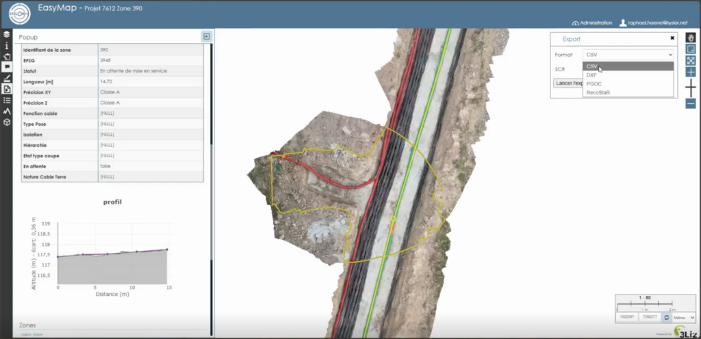
Concatenate Models for a Complete Project Overview
Global Project Management and Tracking
Model concatenation automatically groups multiple photogrammetric surveys into coherent zones. This provides not only a macro view of the project but also continuous monitoring of its progress. This global approach facilitates project management, team coordination, and the progressive updating of data throughout the project. Global statistics (lengths, network types, progress rates) offer a clear and centralized overview.
The choice of the background map allows for better contextualization of the project.

Continuity and Unified Export
Overlapping areas are automatically flagged as attention points. A dedicated process ensures topological continuity between models, reducing connection errors and ensuring smooth, uninterrupted tracing. The entire project can then be exported as a single, consistent file in all standard industry formats.
Result: a single, fast, and consistent export, directly usable in standard industry formats (CSV, DXF, DGN, etc.), with no manual post-processing required.
A Step Toward Greater Automation
These new features already simplify users’ daily workflows by reducing manual corrections and improving coordination. They also mark the next step in Syslor’s broader roadmap: 3D tracing, AI-assisted drawing, and georeferenced annotations will soon further enrich the EasyMap experience.