Ensuring the safety of infrastructure, tracking interventions, and guaranteeing accurate network location is an ongoing challenge. Between project planning, stakeholder coordination, and the need to prevent incidents, you must balance operational performance with data reliability.
Your mission as a network operator: to ensure service continuity, preserve the integrity of infrastructure, and manage works under optimal conditions. To achieve this, you need reliable information that flows seamlessly between the field and the office.
With Syslor, every intervention is tracked, potential damages are anticipated, and project progress is monitored with precision. You gain efficiency, reduce costs related to unforeseen events, and improve coordination between your teams and contractors — all while strengthening the safety of your networks.

Your Challenges
Infrastructure safety, intervention tracking, collaboration between field and office, and management of your data within GIS systems… Discover how Syslor provides practical solutions to each of these challenges, with tools that are easy to deploy and tailored to your operational needs.
Prevent infrastructure damage
ChatGPT a dit :
Work near sensitive networks exposes your teams to risks and can lead to errors caused by discrepancies between plans and real field conditions. Traditional marking and staking can sometimes lack precision, increasing the likelihood of incidents.
With Syslor, augmented reality provides an accurate visualization of underground assets, making marking and staking operations far more reliable and reducing the risk of errors. Thanks to photogrammetry and centimeter-level GNSS precision, you can anticipate future works, safeguard your teams, and protect your networks
Export your deliverables in your GIS formats
The diversity of GIS formats can make data management complex and hinder collaboration with contractors — especially as technologies and regulations evolve (Class A requirements, photogrammetry, etc.).
With Syslor, you can customize your exports to meet your specific needs and obtain data that’s directly usable across all formats. This allows your contractors to work more efficiently and adapt seamlessly to new standards.
Discover our solutionsMonitor work execution
As a network operator, you are responsible for ensuring the quality of network installation. Provide your contractors with augmented reality plans to secure marking operations. Transparently verify the quality of the work performed through photogrammetry and optimize your costs.
Plan works at the scale of a territory
Designing, prioritizing, and securing infrastructure projects requires reliable, up-to-date, and easy-to-use network data. Without this foundation, it becomes difficult to maintain a clear and shared vision of the territory.
With Syslor, you can segment your GIS data according to your needs (by department, region, etc.), make it accessible in augmented reality, and keep it continuously updated through field feedback.
Discover our solutionsBuild an asset database
ChatGPT a dit :
Effective management of your network assets relies on the rigorous and accessible centralization of your data.
With Syslor, you can collect, structure, and update your network information directly from the field, creating a reliable asset database that can be used and shared across teams and contractors.
Our solutions to meet your need
-
Photogrammetry
-
Augmented Reality
-
Field Notebook
Turn your smartphone into a field digitizing tool: generate georeferenced 3D point clouds, usable orthophotos, and perform vectorization with EasyMap.

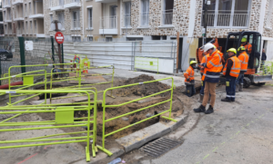
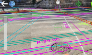
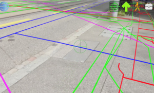
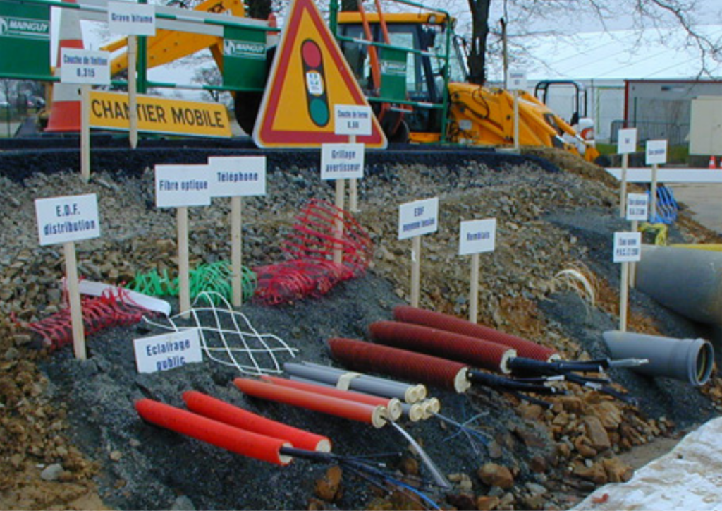
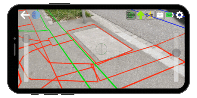
Thanks to our augmented reality technology, instantly visualize the exact location of underground networks, overlaid on your camera view.

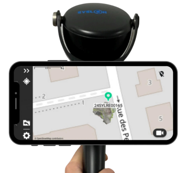
EasyField is a simple and precise digital field notebook for staking out, surveying, and monitoring earthworks — all directly from your smartphone.
They trust us
Our tools support network operators in locating, managing, and modernizing their infrastructure.


Our commitments
At Syslor, we are committed to helping you update your GIS by ensuring Class A accuracy and enabling full compliance with current regulations.

Digital Sovereignty
Our equipment is designed and manufactured in France, and all data is hosted within national territory — technological sovereignty serving your operational security.

Efficiency & performance
Reducing damage, avoiding unnecessary travel, and improving network management — concrete actions to minimize environmental impact and promote sustainable territorial management.

Designed for your operational realities
Our mission: to make network data accessible, actionable, and useful in everyday operations — empowering you to make informed decisions and take effective action, both in the field and at the office.