Your role is to provide your clients with accurate, actionable data delivered within ever shorter deadlines. Your challenges lie in advising your clients, optimizing your travel, and showcasing your expertise through clear and precise deliverables. Your assignments demand accuracy, responsiveness, and optimal data management. From data collection to updates and integration into your GIS, every step must be reliable and efficient.
With Syslor, you can transform client relationships into a collaborative workflow shared between office and field, building long-lasting partnerships. You offer your clients a new experience, gain responsiveness, and strengthen trust through a smoother and more efficient organization.

Your business challenges
Each design office has its own priorities: saving time on plan preparation and travel, making collected data easier to use and share… Discover how Syslor can support you with concrete solutions that are easy to integrate and tailored to your working methods.
Save time on every project
For design offices, coordination between the field and the office often proves time-consuming: incomplete information exchanges, delays due to data processing, multiple trips from the surveyor… all these obstacles slow projects down.
With Syslor, real-time information sharing between the field and the office speeds up your processes. Plans and projects can be visualized in augmented reality, photogrammetric acquisitions are quickly usable, and information exchanges (surveys, layout plans) are immediate. Surveyors can focus more precisely on their areas of expertise, and projects move forward faster.
Discover our solutionsLeverage collected data
Design offices must manage a large volume of data while meeting regulatory requirements. This means balancing accuracy, reliability, and efficiency in the production and use of field information.
With Syslor, you can capture and visualize your projects, carry out surveys and stakeouts with ease, all while ensuring accuracy. From the portal, you manage your projects and teams, create as-built drawings, and export your deliverables with complete simplicity.
Discover our solutionsBuild client loyalty
Your clients’ trust relies on the quality of your deliverables and the transparency of the information you share.
With Syslor, you establish a collaborative workflow with your clients, supported by reliable data and accurate deliverables. You demonstrate the quality of your services and strengthen long-term relationships.
Discover our solutionsEnsure proper execution of works
Compliance control between planned designs and executed works helps avoid discrepancies, secure networks, and produce reliable as-built records. You need to be able to monitor the work before delivery and easily share information with your clients.
With Syslor, you track the location of installed networks, document each step, and ensure rigorous monitoring of interventions, in real time or afterwards. You simplify the inspection process and effortlessly share reliable information with your clients.
Discover our solutionsSolutions designed to meet your needs
-
Photogrammetry
-
Augmented Reality
-
Field Notebook
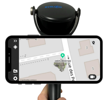
Turn your smartphone into a field digitizing tool: generate georeferenced 3D point clouds, usable orthophotos, and perform vectorization with EasyMap.

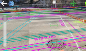
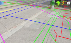
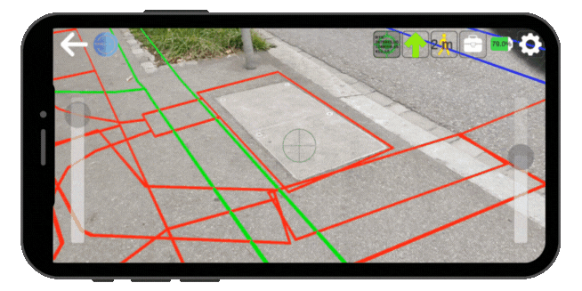
Thanks to our augmented reality technology, instantly visualize the exact location of underground networks, overlaid on your camera view.

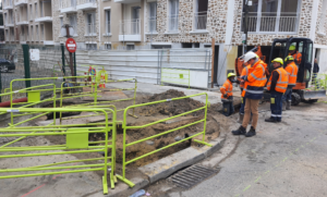
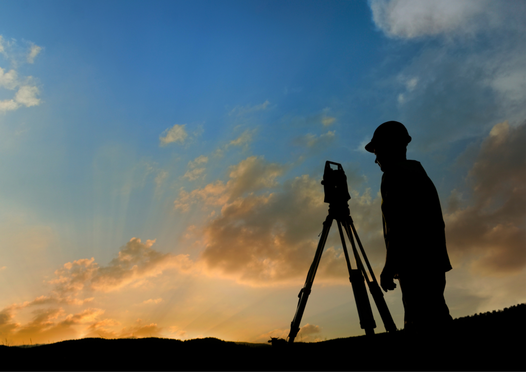
EasyField is a simple and precise digital field notebook for staking out, surveying, and monitoring earthworks — all directly from your smartphone.
Our Commitments
At Syslor, we provide you with the tools to address your different use cases and optimize your operations with solutions that are sustainable, accessible, and built to last.

Digital sovereignty
Our equipment is designed and manufactured in France, with all data hosted on national soil — ensuring technological sovereignty for your operational security.

Sustainability and performance
Reduce damages, cut unnecessary travel, and take control of your networks — tangible actions to lower environmental impact and support sustainable land management.

Tailored to your industry realities
Our mission is to make network data accessible, actionable, and useful — empowering you to act effectively in the field and at the office.
Our clients
Trusted by surveyors and design offices, our solutions ensure reliable surveys and help optimize every project.


