Customizable attributes library
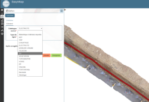
EasyMap offers customizable attribute libraries to structure your objects according to your industry needs: electricity, water supply, district heating, telecom and more.
Multi-format exports
EasyMap exports to DXF, CSV, RecoStaR and PGOC, in a clean, directly usable format, with no post-processing required—even for regulatory deliverables. On request, we can format your exports according to your preferred cartographic standard.
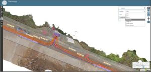
Model concatenation
Group multiple photogrammetric surveys into a coherent, unified overview. Ideal for long linear projects:
continuous tracking, unified visualization, global statistics, base maps, and topological continuity.
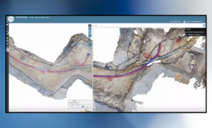
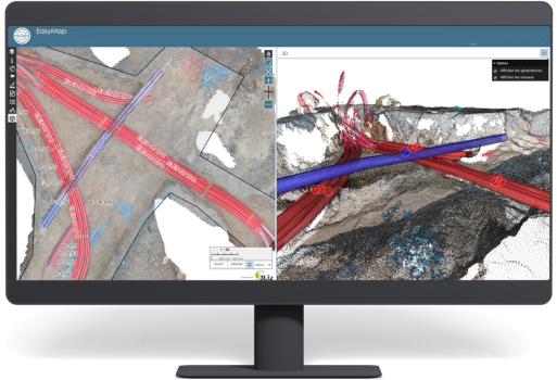
2,5D/3D dual view
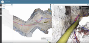
Combine the simplicity of 2.5D tracing with the elevation control of the 3D point cloud to fine-tune your geometries with precision. This dual view makes it easier to validate complex areas and increases the reliability of the as-built documentation.
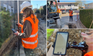
Precise measurements
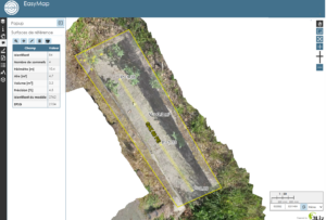
Calculate in one click: linear distances, areas, volumes and cut/fill quantities, as well as elevations and level differences.
The centimeter-level accuracy provided by EasyScan ensures reliable results with no manual re-entry.
Longitudinal & cross profiles
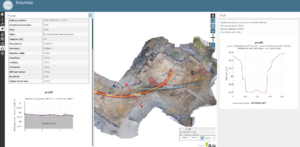
Instantly generate sections to check depths, analyse terrain elevation, validate sensitive areas, and verify network crossings.
A key feature for utility projects and dry or wet network installations.