Photogrammetry has become an essential technique for documenting and analyzing construction sites, particularly in the context of as-built surveys of underground networks.
It enables the production of georeferenced deliverables in various forms, such as point clouds, orthophotos, digital terrain models (DTMs), or even 3D meshes.
Photogrammetric deliverables can be difficult to leverage due to the complexity of the data and the analyses required.
Fortunately, some software tools—such as EASYMAP®—accessible through our web portal, greatly simplify this process, making these deliverables far more accessible to non-expert users.
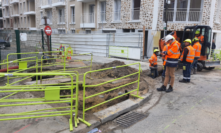
Let’s explore the practical applications of data collected using as-built tools like EasyScan®.
Solutions for leveraging data collected through as-built surveys
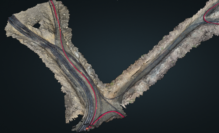
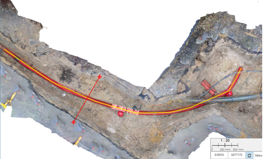
Vector mapping of utility networks
Combining orthophotography with a digital terrain model (DTM) enables vertical projection, making it easy, fast, and accurate to vectorize the upper generatrices in 3D.
This vectorization can be exported in various formats, allowing it to be used and integrated into Geographic Information Systems (GIS) or Computer-Aided Design (CAD) software, ensuring smooth interoperability between all project stakeholders.
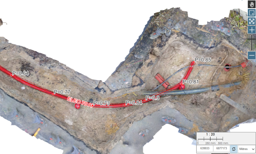
Handling longitudinal and cross-sectional profiles
This vectorization comes with the ability to generate longitudinal and cross-sectional profiles, enabling continuous control of the tracing process. This ensures tracing reliability that meets the accuracy requirements of Class A.
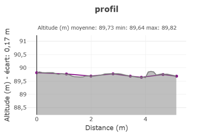
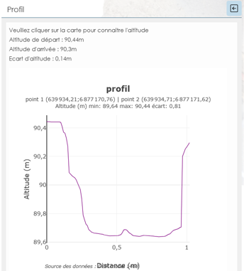
Profiles produced with Sysmap
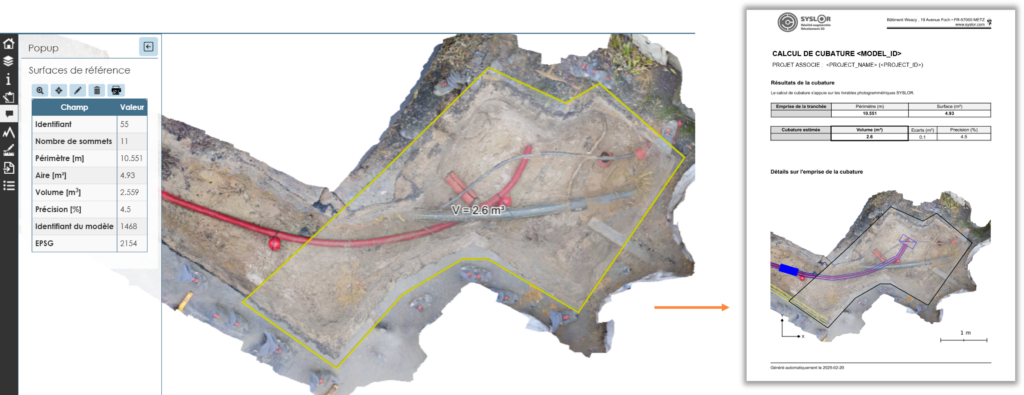
Area measurement and cut/fill volume computation
The drawing interface allows users to measure the surface areas of intervention zones, making it possible to directly assess excavated areas and optimize land use.
This surface also serves as the basis for precise volumetric measurements.
The Sysmap solution helps optimize earthwork costs by providing accurate resource estimates and ensuring project compliance.
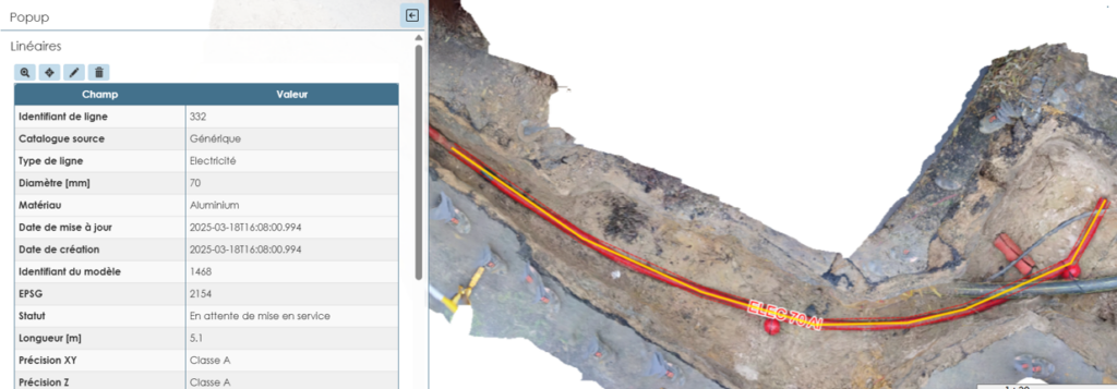
Depth measurement of utility networks
During network as-built surveys, photogrammetric deliverables make it possible to determine the depth of vectorized vertices from a reference surface — a crucial element for:
Ensuring compliance with safety and utility location standards;
Improving the quality of as-built plans by providing accurate data on pipeline burial depths.

Photogrammetric deliverables go far beyond simple visualization: they enable the extraction of numerous precise measurements—vectorization, surface area, volume, depth—making them true decision-support tools for site managers and agency directors.
They enhance as-built survey accuracy, optimize costs, and contribute to better management of underground infrastructure.
With Sysmap—our tracing module designed to leverage photogrammetric deliverables—network tracing is performed with precision.
This process ensures reliable, usable data that is essential for future projects: building asset records, reducing damage to infrastructure, saving time, and optimizing upcoming interventions.
By combining high-quality surveys with dedicated tools like Sysmap, photogrammetric deliverables become true management assets—enabling more efficient and better-anticipated construction projects.