An energy network operator cuts the time spent on marking by a factor of 8
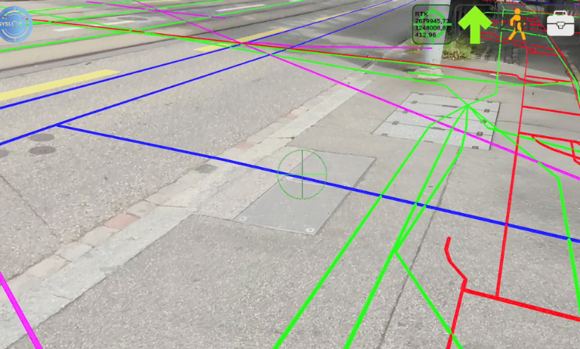
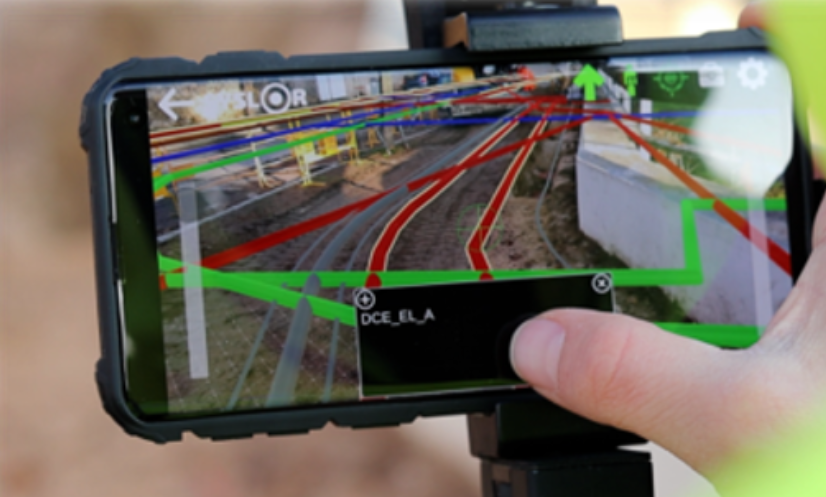
Digitalising the marking of underground networks for greater safety and efficiency Operating in the Lorraine Nord, Provence and Pays Basque/Landes regions, a network operator has launched an ambitious project to encourage the adoption of digital staking marking solutions while guaranteeing a high level of safety for its operators and reliability in locating buried structures. Solution implemented: EasyView and Augmented Reality at the heart of the field Syslor supported this customer in the deployment of a complete augmented reality ground marking solution for visualising and tracing buried networks: EasyView. The EasyView solution is based on : The Proteus GNSS receiver for centimetre-level geolocation (class A) The EasyView mobile application for augmented reality viewing of networks directly on site A customised conversion key for integrating GIS data with enriched attributes (type, diameter, depth, etc.) Automated processing of network files: tiling, integration and monthly updates. The solution has been deployed in 3 agencies covering 8 administrative districts, with more than 450 sites marked. Challenges encountered Making operations safer and limiting the risks for operators Digitising buried networks to simplify operations Standardising tools and practices between territories Speeding up the adoption of digital tools by field teams The results achieved The results are indisputable: Marking and staking 2 to 8 times faster depending on the case Augmented reality display of networks even in the absence of a GNSS map Strong support from teams in the field, who don’t want to go back. Testimonials from the field Some customer feedback: “Data loading is fast.”“Significant time saving on marking: 15 to 20 minutes instead of 30 to 40!” “I save up to 8 times the marking time.”“I couldn’t go back. Syslor is an indispensable tool.” “Very useful when you don’t have a background plan!” “When I arrived on site, I knew straight away whether there was gas or not.” Perspectives Extension of use to all branches Complete automation of the GIS process ➝ in the field (provision of data) Progressive enrichment of network data: depth, date of installation, material, nominal diameter. A concrete and measurable digital transformation Thanks to the EasyView solution, this network operator has modernised its approach to marking and staking, while reducing its operational risks. Visualising networks in augmented reality has become a strategic lever for efficiency, autonomy and safety for its teams. Would you like to test EasyView on your worksites? Contact us or request a demonstration.
An energy network operator cuts the time spent on marking by a factor of 8 Read Post »